Wetlands – Interior: Shrinking Footholds
WHAT?
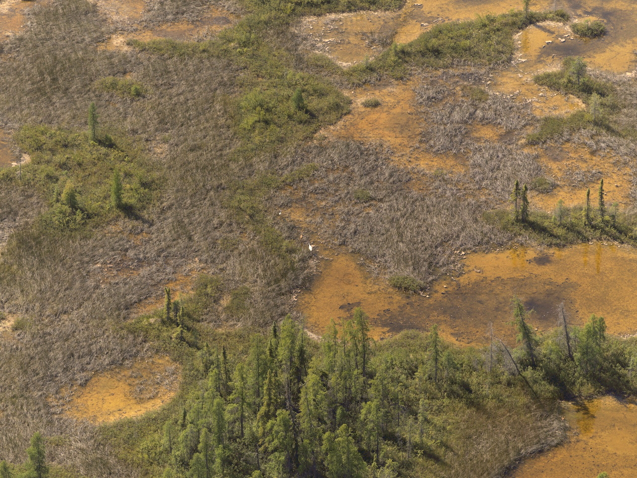
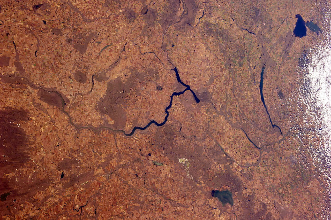
Interior freshwater wetlands are areas that have fresh water in large enough amounts through rain and melted snow to remain on the surface of poorly drained land after the ground below is soaked or saturated. In North America, the four main categories are based on the type of plant growth or vegetation present, and the depth and how permanent the surface water: ponds, swamps, marshes and peat bogs. They aid in reducing floods as wetlands absorb water during flood conditions and slowly release water when there is a drought.
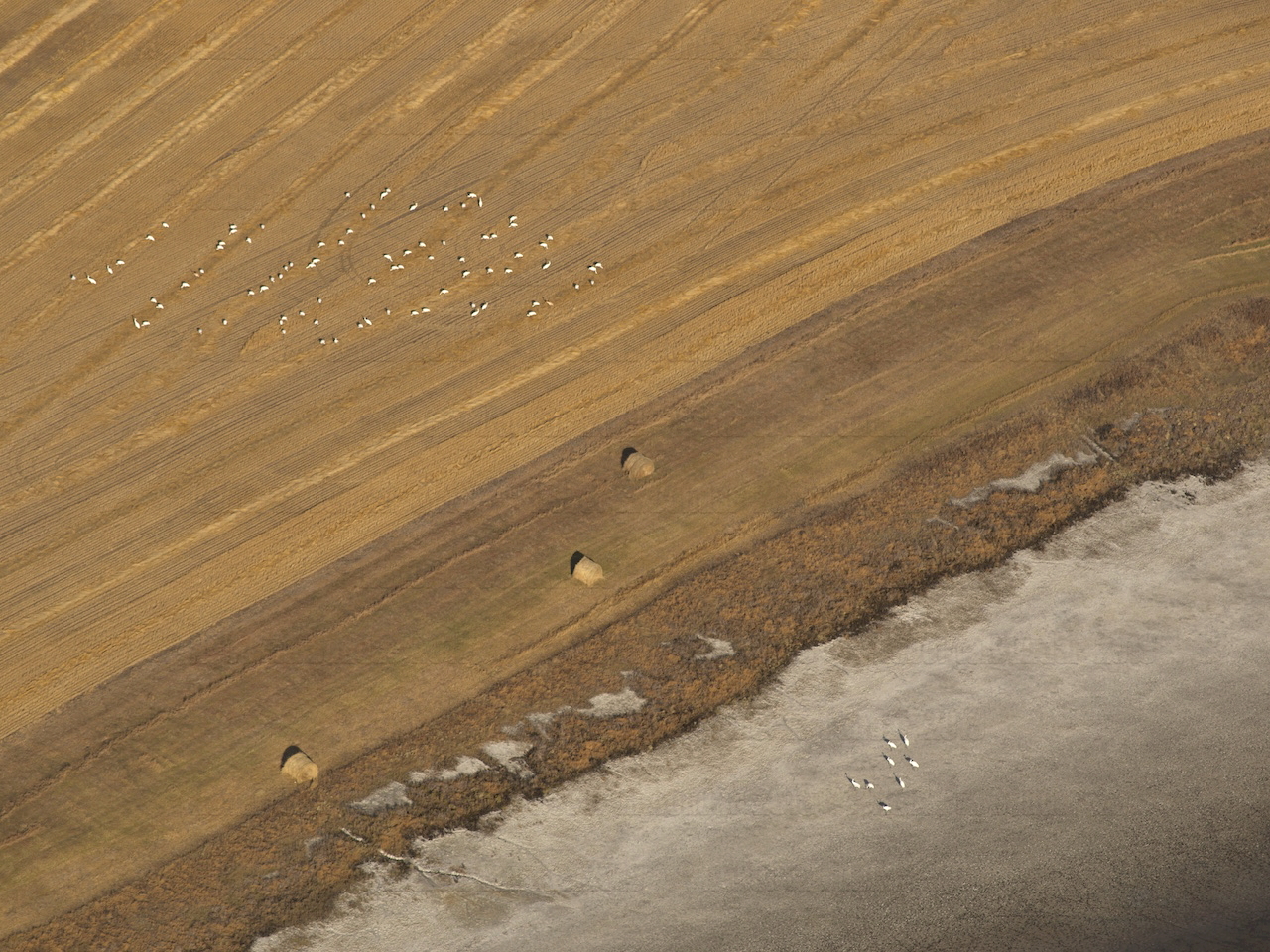
Many birds rest and feed on freshwater wetlands during migration and over the winter.
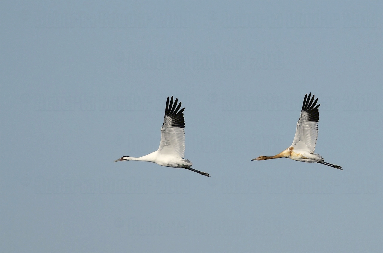
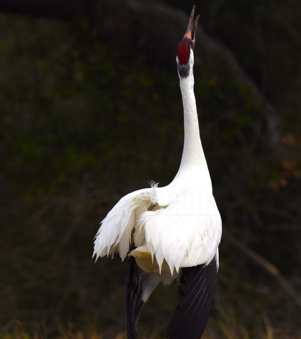
In the fall, the endangered Whooping Crane, the largest bird in North America, flies from interior freshwater wetlands in the Northwest Territories in Canada to its overwintering area in the saltier coastal wetlands in Texas, along the Gulf of Mexico, and back again each spring. Whooping Cranes touch down several times on their 4000 km migratory journey in each direction. It is illegal in both the USA and Canada to hunt Whooping Cranes, and with several important wetlands protected along their migratory flightpath, their numbers have slowly risen from a low of 15 Whooping Cranes in the world 70 years ago to just over 500 in the wild today.
DID YOU KNOW?
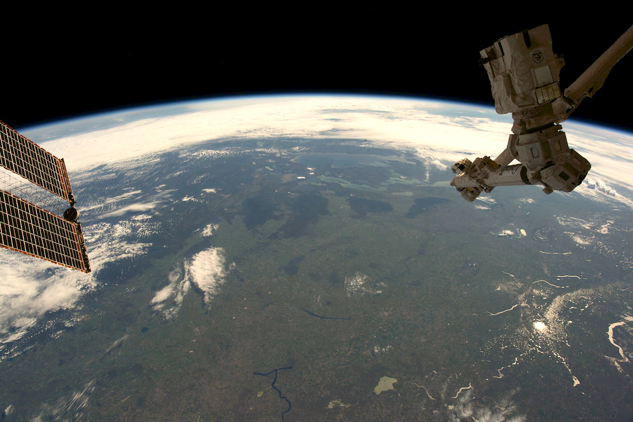
When photographing the Earth from space, we can find oceans, lakes, rivers and ponds better when we use sunglint—sunlight reflecting back to our eyes from the surface of water. Sunglint highlights the uneveness of the surface of water and helps us to see the currents and even winds on top of the water. Because the ocean always has some movement on its surface, the reflection of the sun that we see when we are in space isn’t a perfect sun. It appears blurred as the sun’s light is scattered by the ocean waves and does not come back to our eyes as a perfectly round sun.
BENEFITS OF SPACE:
Photography from space inspires us to create the right balance between the needs of human beings and those of other forms of life. Satellites provide information on the use of land and inland fresh water by human beings and how much is still in its natural state.
In the images from space, we can see that wetlands have been shrinking over time. Frequently, wetlands are drained and replaced by the development and expansion of human settlements with loss of wildlife. Without wetlands and the food that they provide, birds will try to forage (search for food) on surrounding farmlands.
FUN FACT!
The red patch on the top of the head of the Whooping Crane and the Sandhill Crane is almost featherless skin that can change in size and intensity of red when their attitude or emotions change, such as when they become aggressive towards predators or protective of their habitat.
Dr. Roberta Bondar produced the original version of this Wetlands article to support the Canadian Space Agency’s Exploring Earth: Map of our planet project. Explore!